
Telangana Resolves First Land Dispute Using Survey Map and Bhoodhar System
Telangana introduces survey map and Bhoodhar system to resolve land disputes ensuring transparency accurate ownership and secure registrations while boosting farmer confidence through integrated land management reforms.
- Telangana land dispute resolved using survey map
- Bhoodhar system ensures clear land ownership
- Survey map registration boosts farmer confidence
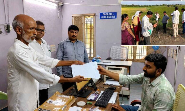
In a significant step toward land reforms, Telangana has resolved its first land dispute using a verified survey map, marking a shift towards transparent and technology driven land administration.
The case was settled in Khammam district where a land transaction between two farmers was completed with clear documentation of boundaries. Authorities attached a detailed survey map during registration, ensuring that both parties had a precise understanding of the land parcel.
Officials issued a unique Bhoodhar number along with a digitally verified land map, eliminating any ambiguity around ownership. This approach is expected to reduce future disputes by establishing clarity at the time of registration itself.
Revenue and Housing Minister Ponguleti Srinivas Reddy said that land is central to a farmer’s life and securing ownership rights is essential for long term stability. He emphasized that verified records bring confidence to farmers and provide a sense of security to families.


The government has been working on integrating various departments to simplify land related processes. A unified platform now connects survey, land and registration systems, allowing faster and more reliable services for citizens.
As part of pilot implementation, the new system is being tested in select regions before expanding across the state. Authorities believe that making survey maps mandatory during registrations will play a crucial role in preventing disputes.
Advanced technology has also been introduced to improve accuracy in land measurement. Modern tools are replacing older methods, helping officials generate precise maps and records.
The initiative reflects Telangana’s broader aim to build trust in land ownership and create a system where disputes are resolved quickly with clear and verified information.


